Chocó & Valle del Cauca, Colombia
Pacific Coast Descent
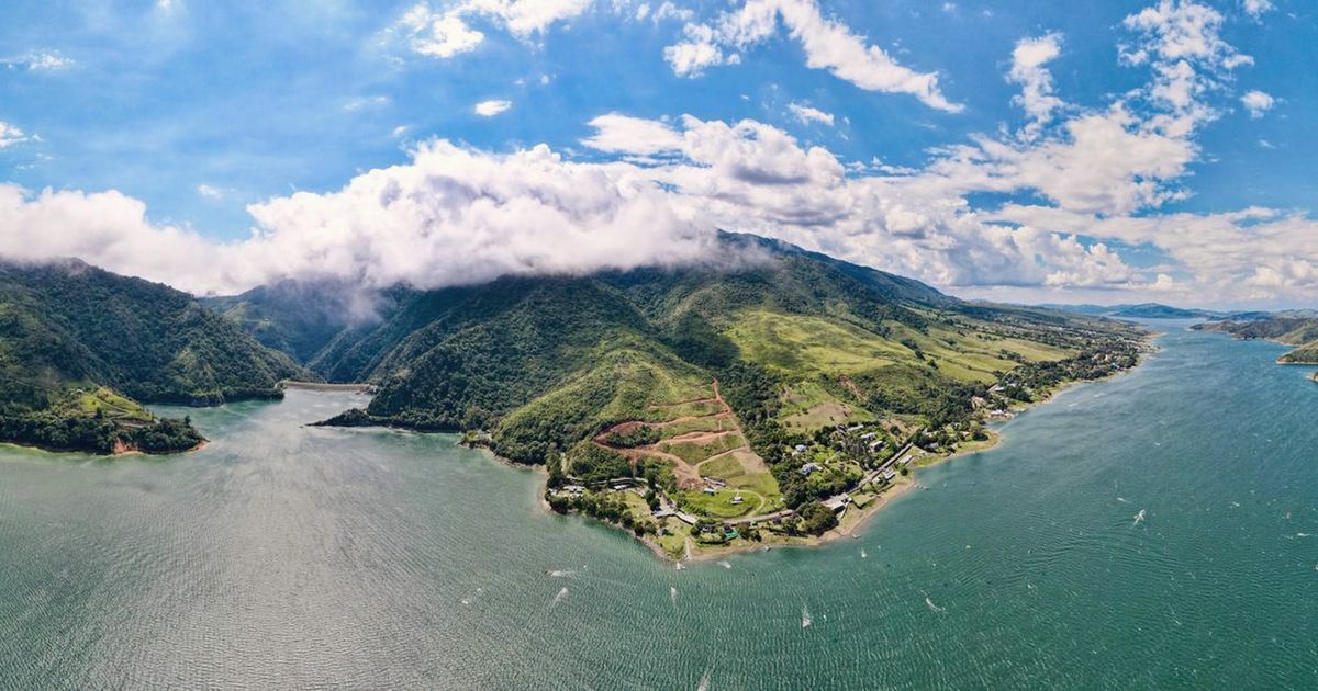
Cloud forest ridgelines unwinding, hour by hour, toward a wide grey-blue ocean.
Why this monthColombia's mid-year dry spell runs on: clear ridgelines at dawn and a coastal road with almost nothing on it.
Full route, maps & GPX on BicycleMovementOpens the official page in a new tab. Nothing is sold here — how the link works.
- Distance
- 430 km
- Duration
- 7 days
- Ascent
- 5,600 m
- Country
- Colombia
The seasonColombia's mid-year dry spell runs on: clear ridgelines at dawn and a coastal road with almost nothing on it. How we read the weather window · the September edition.
The Soul Score is BicycleMovement's official figure for this route, shown here exactly as published on Pacific Coast Descent route page.
Best time to cycle Pacific Coast Descent
- Best months
- July – August, and December – March
- Difficulty
- Demanding
Colombia's Pacific slope has two dry spells. The mid-year one, through July and August, is the kinder of them: nights at altitude stay cool, mornings sit clear above the cloud line, and the rain that does arrive comes late in the afternoon as a soft front rather than a storm. The December to March window is drier still but busier, and the descent loses some of its emptiness.
We would avoid September to November, when the Pacific slope is at its wettest. See the month-by-month weather window for Colombia
How hard is Pacific Coast Descent?
5,600 m of ascent across seven days is a real load, and most of it is gathered in the first half while the route climbs into coffee country and along the ridge. Gradients are steady rather than steep; the difficulty is altitude, humidity on the descent, and gravel connectors that ask for patience and wide tyres.
On the roadSealed secondary roads with gravel connectors along the ridge; the descent is long rather than steep. Villages every 30–40 km for water and food, simple rooms without booking ahead, and 40 mm tyres or wider for the unsealed sections.
Gradients, surface changes and the full elevation profile are published on the official Pacific Coast Descent page on BicycleMovement, which is the complete version of this journey.
What the route is remembered for
The ridge above the cloud
Two days of high riding where the cloud sits below the road in the morning and the villages appear out of it one by one.
A descent measured in days
Thousands of metres let go slowly, from cool cloud forest into warm river air, with no need to touch the pedals for long stretches.
Coffee country at first light
Early hours through small farms, the smell of drying beans, and roads that carry almost nothing but the morning.
The Pacific at the end
A wide grey-blue ocean and a town that keeps its own time, reached flat and slow after a week of altitude.
Pacific Coast Descent cycling itinerary
7 days of riding, 430 km and 5,600 m of ascent, shaped the way we would ride it — short mornings, long afternoons, and no day that has to be finished.
Days 1–2
Out of the valley
Leave the Cauca valley on secondary roads and climb steadily into coffee country, gaining the first ridgeline before the afternoon cloud arrives.
Days 3–4
Cloud forest ridge
The long high section: gravel connectors between ridge villages, clear mornings above the cloud line, cool nights at altitude.
Days 5–6
The descent
A drop of thousands of metres over two unhurried days, from cloud forest into humid lowland air and river crossings.
Day 7
Pacific
Flat final kilometres to a wide grey-blue ocean and a town that keeps its own time.
The full route
GPX files, offline maps, the elevation profile, day-by-day notes and the planning tools for Pacific Coast Descent all live on BicycleMovement. We keep only the season and the reason.
Get the GPX + full route on BicycleMovementOpens the official page in a new tab. No signup here, nothing sold here.
Pacific Coast Descent: common questions
- When is the best time to ride Pacific Coast Descent?
- July – August, and December – March. Colombia's Pacific slope has two dry spells. The mid-year one, through July and August, is the kinder of them: nights at altitude stay cool, mornings sit clear above the cloud line, and the rain that does arrive comes late in the afternoon as a soft front rather than a storm. The December to March window is drier still but busier, and the descent loses some of its emptiness. Month-by-month season guide for Colombia
- How many days does it take?
- 7 days at an unhurried pace — 430 km with 5,600 m of ascent through Chocó & Valle del Cauca, Colombia. Strong riders shorten it; we would not. The day-by-day breakdown, with distances and overnight options, is on the full Pacific Coast Descent route page.
- How difficult is Pacific Coast Descent?
- Demanding. 5,600 m of ascent across seven days is a real load, and most of it is gathered in the first half while the route climbs into coffee country and along the ridge. Gradients are steady rather than steep; the difficulty is altitude, humidity on the descent, and gravel connectors that ask for patience and wide tyres.
- What are the roads and surfaces like?
- Sealed secondary roads with gravel connectors along the ridge; the descent is long rather than steep. Villages every 30–40 km for water and food, simple rooms without booking ahead, and 40 mm tyres or wider for the unsealed sections.
- How do I get to the start?
- Start from Cali, three hours from an international airport, and return by regional bus or a short flight from the coast. Bikes travel on the buses without ceremony.
- Where do I download the GPX file, maps and elevation profile?
- On the official route page. Get the GPX for Pacific Coast Descent on BicycleMovement — offline maps, the elevation profile and the planning tools are held there too.
The full route
GPX files, offline maps, the elevation profile, day-by-day notes and the planning tools for Pacific Coast Descent all live on BicycleMovement. We keep only the season and the reason.
Open the official route pageOpens the official page in a new tab. No signup here, nothing sold here.