Wild Atlantic Way, Ireland
The Atlantic Lanes
Hedgerow lanes and a sea that is never quite the same colour twice.
Why this monthOne of Ireland's steadiest months: mild air, softer winds than autumn brings, and lanes returned to the people who live on them.
Full route, maps & GPX on BicycleMovementOpens the official page in a new tab. Nothing is sold here — how the link works.
- Distance
- 412 km
- Duration
- 7 days
- Ascent
- 4,900 m
- Country
- Ireland
The seasonOne of Ireland's steadiest months: mild air, softer winds than autumn brings, and lanes returned to the people who live on them. How we read the weather window · the September edition.
The Soul Score is BicycleMovement's official figure for this route, shown here exactly as published on The Atlantic Lanes route page.
Best time to cycle The Atlantic Lanes
- Best months
- June – September
- Difficulty
- Moderate
The Irish west coast is never dry, but late summer is as settled as it gets: mild air, long evenings, and weather systems that pass through in hours instead of days. Wind matters more than rain here — ride south to north or north to south depending on the forecast, and a hard day becomes an easy one.
We would avoid the winter months, when daylight and weather both close in. See the month-by-month weather window for Ireland
How hard is The Atlantic Lanes?
The total ascent gathers in small pieces rather than big passes — narrow lanes with frequent short climbs, some of them steep for a few hundred metres. Weather moves fast off the ocean, so plan shorter days than the map suggests and carry a proper shell.
On the roadNarrow single-track lanes with frequent short climbs; the total ascent gathers in small pieces rather than big passes. Weather moves fast off the ocean — a proper shell, and shorter days than the map suggests.
Gradients, surface changes and the full elevation profile are published on the official The Atlantic Lanes page on BicycleMovement, which is the complete version of this journey.
What the route is remembered for
Single-track lanes above the sea
Roads barely wide enough for a car, with grass down the middle and the Atlantic below.
Light that changes hourly
Squalls, clearings and long golden evenings, sometimes all within one afternoon.
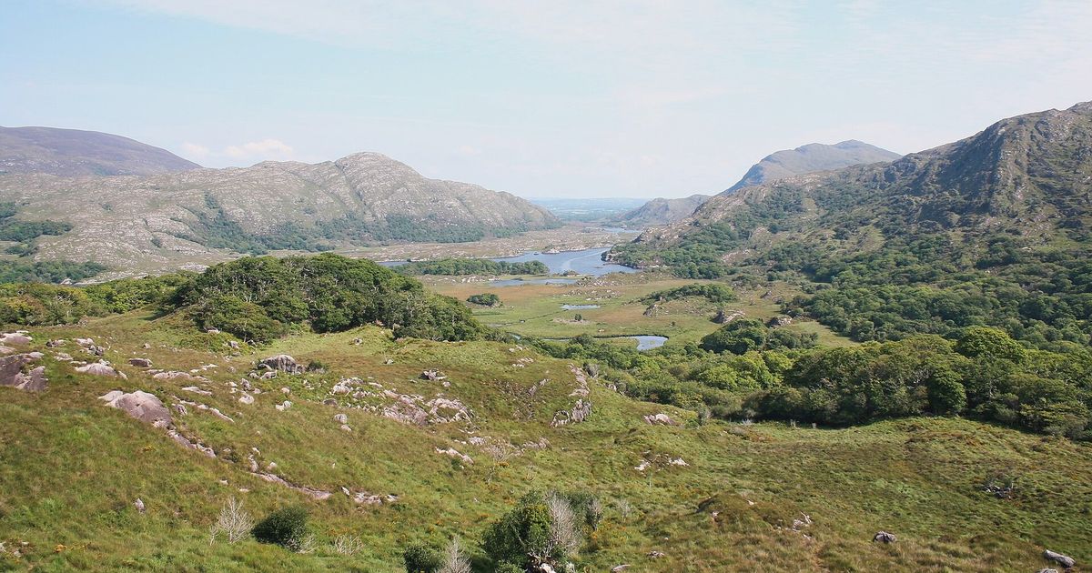
Ladies View and the high ground
Lakes, bog and open moor from the few sections that climb away from the coast.
Villages built around one street
Somewhere to dry out, eat, and hear the weather discussed properly.
The Atlantic Lanes cycling itinerary
7 days of riding, 412 km and 4,900 m of ascent, shaped the way we would ride it — short mornings, long afternoons, and no day that has to be finished.
Days 1–2
Southern lanes
Hedgerow lanes inland of the main coast road, with the prevailing wind at your back.
Days 3–4
Peninsulas
Out and back along headlands, each with a climb, a view and a village at the end.
Days 5–6
Cliffs and bog road
Exposed coastal riding with weather that changes hourly, and long empty inland sections.
Day 7
North
A last run to the finish, timed for the low evening light on the water.
The full route
GPX files, offline maps, the elevation profile, day-by-day notes and the planning tools for The Atlantic Lanes all live on BicycleMovement. We keep only the season and the reason.
Get the GPX + full route on BicycleMovementOpens the official page in a new tab. No signup here, nothing sold here.
The Atlantic Lanes: common questions
- When is the best time to ride The Atlantic Lanes?
- June – September. The Irish west coast is never dry, but late summer is as settled as it gets: mild air, long evenings, and weather systems that pass through in hours instead of days. Wind matters more than rain here — ride south to north or north to south depending on the forecast, and a hard day becomes an easy one. Month-by-month season guide for Ireland
- How many days does it take?
- 7 days at an unhurried pace — 412 km with 4,900 m of ascent through Wild Atlantic Way, Ireland. Strong riders shorten it; we would not. The day-by-day breakdown, with distances and overnight options, is on the full The Atlantic Lanes route page.
- How difficult is The Atlantic Lanes?
- Moderate. The total ascent gathers in small pieces rather than big passes — narrow lanes with frequent short climbs, some of them steep for a few hundred metres. Weather moves fast off the ocean, so plan shorter days than the map suggests and carry a proper shell.
- What are the roads and surfaces like?
- Narrow single-track lanes with frequent short climbs; the total ascent gathers in small pieces rather than big passes. Weather moves fast off the ocean — a proper shell, and shorter days than the map suggests.
- How do I get to the start?
- Kerry, Cork and Shannon airports all sit within a short ride or bus of the route, and trains reach the larger towns.
- Where do I download the GPX file, maps and elevation profile?
- On the official route page. Get the GPX for The Atlantic Lanes on BicycleMovement — offline maps, the elevation profile and the planning tools are held there too.
The full route
GPX files, offline maps, the elevation profile, day-by-day notes and the planning tools for The Atlantic Lanes all live on BicycleMovement. We keep only the season and the reason.
Open the official route pageOpens the official page in a new tab. No signup here, nothing sold here.